Design Science Association
Education and adventure in the field of Creation Science.
What is the Design Science Association?
Design Science Association is a Portland, Oregon based outreach offering opportunities for education and adventure in the field of Creation Science. Highlights include:
- Monthly Meetings featuring prominent Creation Science Speakers.
- Book Store offering the latest and best Creation Science resources at discount prices.
- Field Trips exploring the handiwork of our Creator, Jesus Christ, as well as the evidence for the global flood of Noah’s day.
Upcoming Events
MONTHLY MEETING: July 19, 2025
What do sediments tell us about the Flood?
Michael J. Oard
A major goal of Flood geology is to develop a sophisticated model of the Flood that explains field data, one that will reconcile over two centuries of uniformitarian effort with biblical history. The first step in a data-driven model is to determine the global volume, thickness, and distribution of Flood sediments. Finding any volume requires knowing the bounding surfaces. Since Flood sediments are exposed in many areas, or lie under a thin veneer of post-Flood sediment, a digital elevation model (DEM) is a good approximation of the top. Mapping the basal boundary of the Flood is more complex, but can be done in many areas. The Flood Sediment Research Project was developed to begin creating GIS maps, and to ask and answer geological questions.
GlobSed has provided us with the best current approximation of sediment distribution in the ocean. It has demonstrated that the vast majority of marine sediments lie along continental margins, reaching 18 km in thickness in offshore rifts and in basins like the Gulf of America. Using GlobSed, we assumed that all of the continental margin sediment and half of that found in the deep ocean resulted from runoff during the Recessive Stage of the Flood. Then we derived a volume for sediment eroded from North America. That volume was equal to an average eroded thickness of 1,900 m (6,200 ft). The same exercise can be replicated for other continents.
That leaves the volume remaining on the continent. The first area we tackled was the upper midcontinent region, which includes Kansas, Nebraska, South Dakota, North Dakota, Minnesota, Iowa, Missouri, Kentucky, Illinois, Indiana, and Ohio. Based on a pilot project in Colorado, we derived volumes and average thicknesses of Flood and Ice Age sediments for each of these states. So far, we are seeing a rough average of 1,800 m (5,900 ft). For the area studied, this suggests that as an average of 3,700 m (12,100 ft) accumulated on North America at the peak of the Flood. Some of the questions raised by this study have focused on the origin of this vast amount of sediment, how it was transported, and why it is mostly fine-grained.
Our mapping also showed amazing features that date to the earliest parts of the Flood, including enormous rifts filled by massive basalt flows and sediment. It shows large sedimentary basins, such as the nearly-circular Michigan and Williston Basins. We have even seen tall pinnacles of basement rock, similar to erosional remnants, indicating tremendous erosion prior to the deposition of Flood sediments.
We are currently finishing the Appalachian region and the Atlantic Coastal Plain. The Appalachians include highly metamorphosed rock that was thrust northwest to form the mountain chain. In the Piedmont and under coastal plain sediments are a number of sedimentary basins down the Atlantic coast. These are infilled by unmetamorphosed, non-marine sedimentary rock. They contain some coal but are well known for their tracks and trackways, including dinosaur prints, such as the ones of the Hartford Basin of Connecticut. The presence of in situ terrestrial animals places the deposition of these sediments before the peak of the Flood and raises provocative questions about the early Flood.
The base of the coastal plain sediments does not represent the base of the Flood, but the base of the Recessive Stage, with its significant erosion of the Appalachians and Piedmont into the deepening Atlantic basin, followed by the deposition of thick sediments, extending out into the ocean.
The Atlantic margin, the Gulf of America, and the Arctic Ocean represent the major depocenters of this phase of the Flood. Our goal is to map the base of the Flood and the base of the Recessive Stage for all of North America. Other geologists can then use this data to test their ideas in our collective quest to understand the Flood.
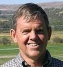
Michael J. Oard has a B.S. and M.S. in Atmospheric Science from the University of Washington. He has worked in atmospheric research and retired from the U.S. National Weather Service after 30 years of service. Michael has worked in creation research in the earth sciences for about 50 years and is the author, co-author, editor of many creation science books on the Ice Age, the Flood, geology, and weather. He also has published hundreds of research article in the creation science literature. He is a fellow of the Creation Research Society. Michael has been married 55 years and has four grown children, 12 grandchildren, and 2 great grandchildren. His web site is Michael.Oards.net, with two free ebooks.
We meet the
third Saturday of each month from
9:00 am to 11:30 am at:
Greater Portland Bible Church
2374 SW Vermont Street
Portland, OR 97219
Creation Encounter Field Trips
Design Science Association hosts field trips through Creation Encounter. Our purpose is to provide quality creation field study, tours, road guides, and other information glorifying God as Creator. We also conduct special field trips for local pastor groups, and offer "tailor-made" creation programs for various organizations. Our mission is to help believers defend the reliability of the Bible and to support the church in fulfilling its Great Commission.
Livestream
The meeting will stream live every third Saturday of the month at 9am Pacific. Click below to watch it LIVE. Did you miss the Livestream? Don’t worry. It’s in our video archive on our YouTube channel.
